


Voting District 33, Cleveland County, Oklahoma
About
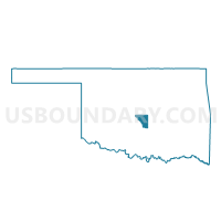
Outline

Summary
| Unique Area Identifier | 653735 |
| Name | Voting District 33 |
| County | Cleveland County |
| State | Oklahoma |
| Area (square miles) | 8.51 |
| Land Area (square miles) | 8.24 |
| Water Area (square miles) | 0.27 |
| % of Land Area | 96.81 |
| % of Water Area | 3.19 |
| Latitude of the Internal Point | 35.10028400 |
| Longtitude of the Internal Point | -97.36827550 |
Maps


Graphs
Select a template below for downloading or customizing gragh for Voting District 33, Cleveland County, Oklahoma


Neighbors
Neighoring Voting District (by Name) Neighboring Voting District on the Map
- Voting District 20, McClain County, OK
- Voting District 21, McClain County, OK
- Voting District 25, McClain County, OK
- Voting District 29, Cleveland County, OK
- Voting District 31, Cleveland County, OK
- Voting District 34, Cleveland County, OK
- Voting District 57, Cleveland County, OK
- Voting District 6, McClain County, OK
- Voting District 9, McClain County, OK
Top 10 Neighboring County Subdivision (by Population) Neighboring County Subdivision on the Map
- East Cleveland CCD, Cleveland County, OK (22,860)
- Purcell CCD, McClain County, OK (17,169)
- Noble CCD, Cleveland County, OK (6,720)
Top 10 Neighboring Place (by Population) Neighboring Place on the Map
Top 10 Neighboring Unified School District (by Population) Neighboring Unified School District on the Map
- Noble Public Schools, OK (15,793)
- Lexington Public Schools, OK (8,240)
- Purcell Public Schools, OK (7,266)
- Washington Public Schools, OK (3,775)
Top 10 Neighboring State Legislative District Lower Chamber (by Population) Neighboring State Legislative District Lower Chamber on the Map
- State House District 46, OK (44,285)
- State House District 42, OK (37,553)
- State House District 27, OK (36,934)
- State House District 22, OK (36,386)
Top 10 Neighboring State Legislative District Upper Chamber (by Population) Neighboring State Legislative District Upper Chamber on the Map
Top 10 Neighboring 111th Congressional District (by Population) Neighboring 111th Congressional District on the Map
Top 10 Neighboring Census Tract (by Population) Neighboring Census Tract on the Map
- Census Tract 4002.02, McClain County, OK (7,996)
- Census Tract 2025, Cleveland County, OK (6,720)
- Census Tract 4003, McClain County, OK (5,497)
- Census Tract 2024.04, Cleveland County, OK (4,397)